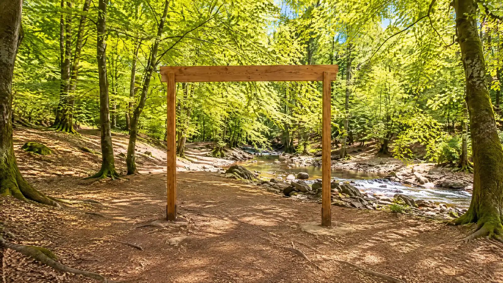
Hoëgne valley walk
Follow the Hoëgne past named waterfalls and timber bridges, then return along the higher forest paths.
01 / The experience
The river path from Belleheid to Pont du Centenaire
Follow the Hoëgne past named waterfalls and timber bridges, then return along the higher forest paths.
Above Belleheid the Hoëgne runs close enough to the path that you spend much of the walk watching it find a way through the rocks. The river begins on the High Fens plateau. Here the ground falls more steeply, and dark pools alternate with little drops and boulder-strewn shallows. The blue-cross route enters the valley from the Pont de Belleheid and crosses the river repeatedly. At one bend the opposite bank feels almost within reach, then the path climbs and you see the same water well below you.
The two named falls carry a piece of Spa’s resort history. Cascade Marie-Henriette and Cascade Léopold II recall the Belgian royal couple. Near the latter, a plaque remembers Léonard Legras, who helped develop the valley as a walking destination. Marie-Henriette inaugurated the waterfall site in 1899. Today a whole series of small cascades competes for attention with the named ones, particularly between the Passerelle Thorez and the Pont du Centenaire.
The Pont du Centenaire takes its name from the centenary of Belgian independence in 1930. The stream is narrower here than it is down by Belleheid. At this point the blue-cross loop changes pace. It crosses the bridge and leaves the river for the higher return paths. The return is part of the character of the walk. After so long among damp rocks and overhanging trees, the forest tracks and the occasional wider view tell you how far you have climbed out of the valley.
Allow around three hours for the marked 10 km loop and longer if you linger by the falls. A shorter outing can follow the river from Belleheid and turn back before the upper climb. The river section still has roots, damp rock and timber crossings, even on the shorter option. If the access ford or paths are closed after heavy rain, the short interpretive trail at Lac de la Gileppe gives you another way to spend time outdoors in Jalhay.
Highlights
- 01
10 km loop · about 3 hours
- 02
Moderate river walk
- 03
Free walk
- 04
Rough paths, bridges and a ford at the car park
04 / Before you go
Plan your visit
Prices & access
The marked walk is free.
When to go
Walk in daylight. Follow local path, ford and parking closures.
High water can cut off the access ford. Timber and rocks are slippery after rain.
Arrival & access
Start at Pont de Belleheid off the N640. The signed drive to the car park crosses a ford. Obey any barriers or flood signs.
Roquez 49, 4845 Jalhay, Belgium
Download walk 55 and wear shoes with grip. Follow the blue crosses.
Plan your visit
Walk independently. Use the official map for the blue-cross loop and the higher return.
Accessibility
The river path has roots, rocks, narrow sections and repeated crossings. The full loop is unsuitable for pushchairs.
Location & nearby places
Continue exploring / the Ardennes during F1
More to explore
in the Ardennes during F1
Find another place for your itinerary, or explore all things to do in the Ardennes during F1.
 Wellness & spaSilva Spa-Balmoral · treatment dayExplore experience →
 Parks & natureLac de la GileppeExplore experience →
 HikingVenntrilogie Stage 4: Botrange to MalmedyExplore experience →
 SkydivingSkydive Spa · tandem jumpExplore experience →
Good to know
Hoëgne valley walk: frequently asked questions
Can I shorten the Hoëgne valley walk from Belleheid in Belgium?
The Hoëgne valley walk in Belgium can be shortened by following the river from Belleheid and turning back before the upper climb. The riverside section still has uneven surfaces and bridges.
Is the Belleheid car park for Belgium’s Hoëgne valley walk accessible in wet weather?
The signed road to Belleheid car park for Belgium’s Hoëgne valley walk crosses a ford. High water or a barrier can prevent access to this starting point.