In depth
Dilmun Burial Mounds at A’ali
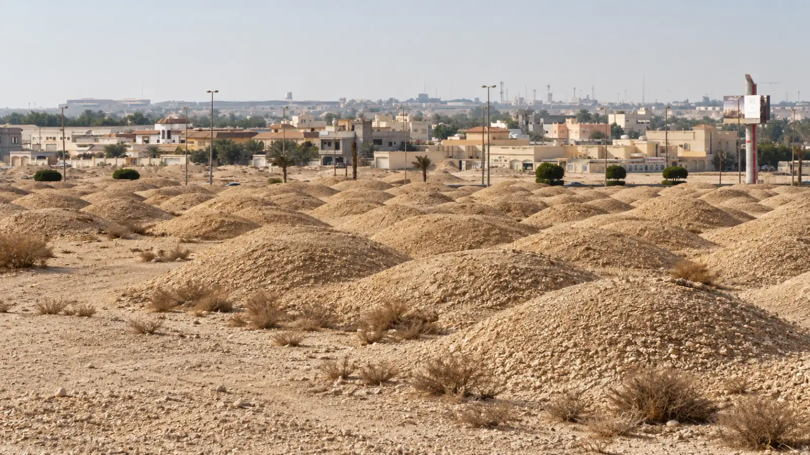
See the mound fields and royal burial landscape of ancient Dilmun at A’ali, with thousands of Bronze Age tombs beside the modern village.
Story · Visit · Route · Links
Visitor Essentials & Quick Answers
Where is the map location for the Dilmun Burial Mounds at A’ali?
The map marks the government-listed A’ali burial landscape near the royal cemetery. It does not identify an authorised tomb entrance or parking bay.
Are A’ali’s Dilmun Burial Mounds natural hills?
A’ali’s Dilmun Burial Mounds cover constructed tombs. Erosion has softened the exterior forms of monuments originally built with chambers and retaining walls.
Can visitors enter a Dilmun burial chamber at A’ali?
Entry to a Dilmun burial chamber at A’ali requires specific authorised access. General visits involve permitted outdoor viewing with heritage visitor advice.
How much time do I need at the Dilmun Burial Mounds in A’ali?
Allow around 45–75 minutes for a selected outdoor stop at A’ali’s Dilmun Burial Mounds. Guiding or authorised archaeological access may take longer.
Which Bahrain museum explains the construction of the Dilmun Burial Mounds?
Bahrain National Museum’s reconstructed burial structures reveal the chambers and construction hidden by a mound’s exterior. The museum is a separate road visit in Manama.
Can I combine A’ali’s Dilmun Burial Mounds with a pottery workshop?
Al-Shughul Pottery Workshop is another cultural stop in A’ali. Arrange its pottery session separately, using the workshop’s own arrival point and participation conditions.
Choose your depth
Essentials or more detail?
See visiting essentials, or read more about the history and places nearby.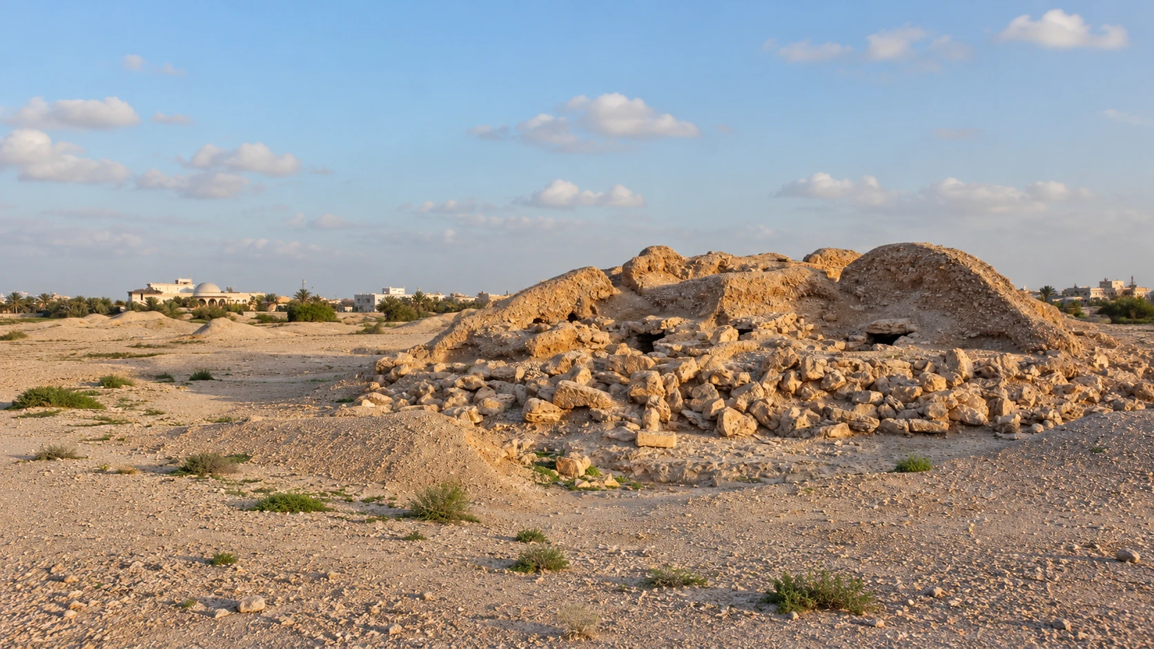
01 The experience
What to expect.
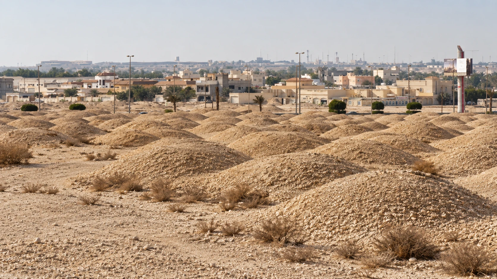
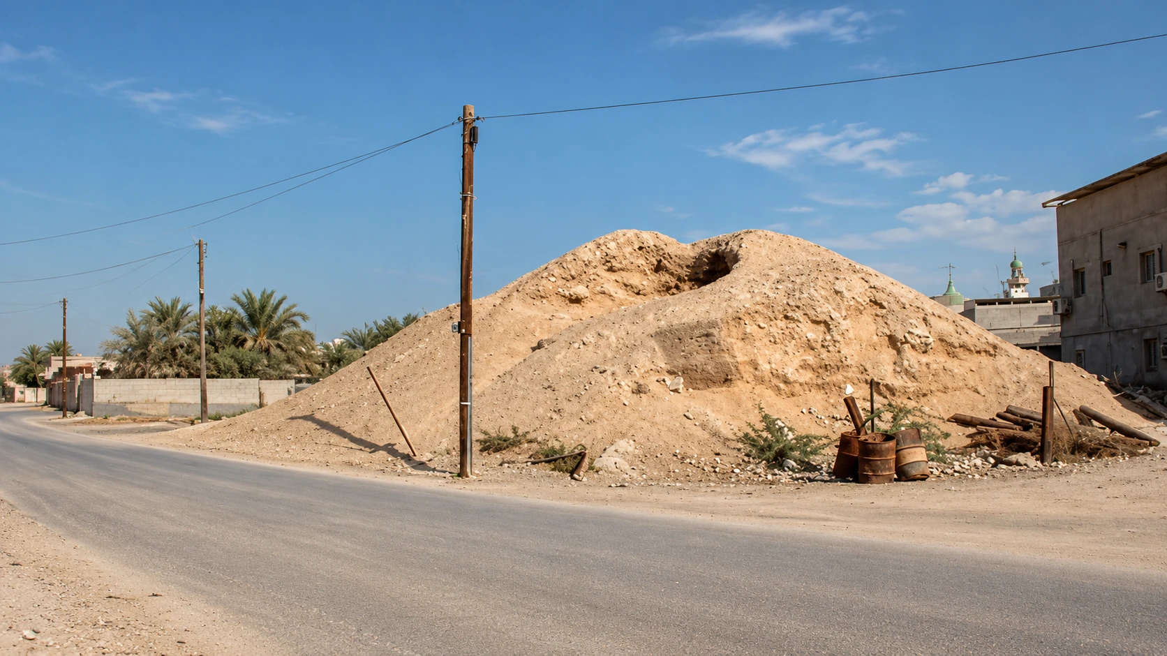
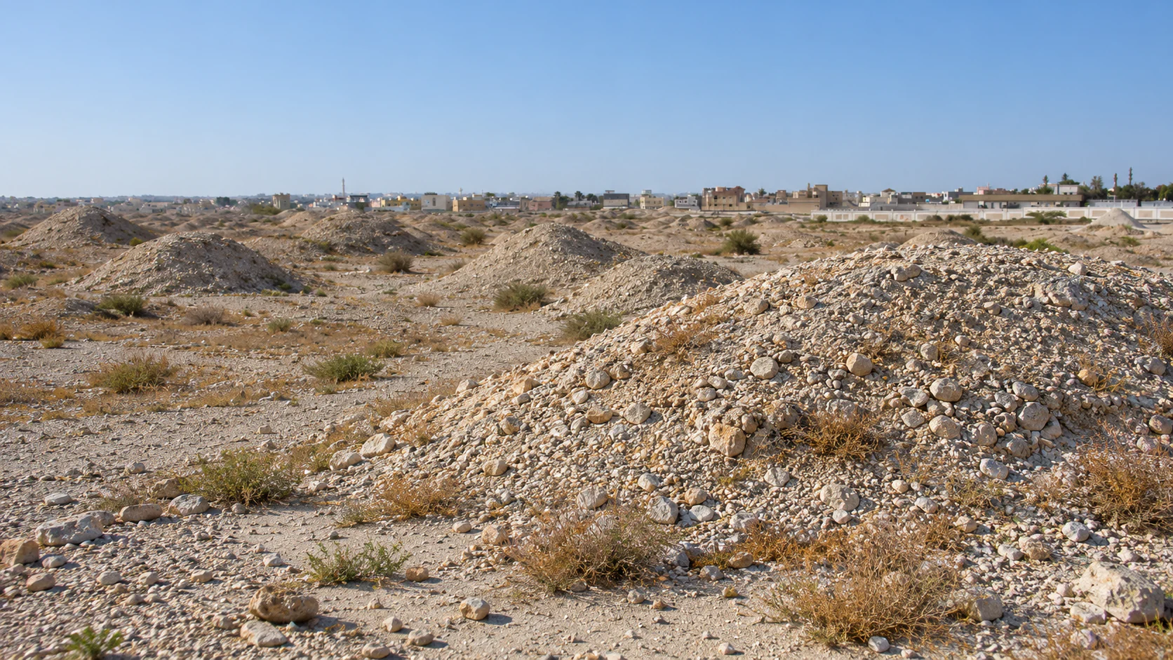
At A’ali, ancient tombs remain part of the view from a modern village. Low mounds gather across the ground, while larger monuments interrupt the urban fabric around the royal cemetery. Houses, roads and working pottery businesses bring the time difference into focus: these are Bronze Age burials within a place where people still live and work.
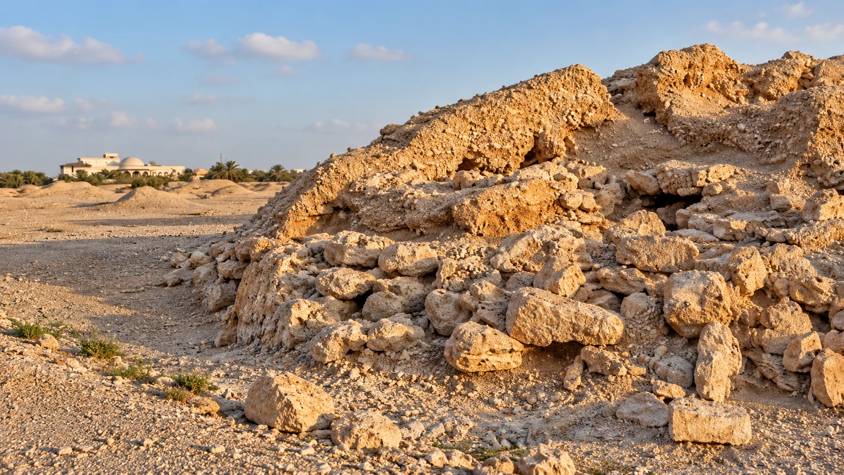
The first impression can be misleading. The rounded shapes resemble small natural hills, but they cover deliberately built chambers. Many tombs began as low cylindrical towers with retaining walls; erosion has softened their profiles. Understanding that original architecture changes the landscape from a field of anonymous humps into a record of people, labour and social difference.
A’ali is one part of the Dilmun Burial Mounds World Heritage property, inscribed in 2019. The wider ensemble includes six mound fields and royal monuments across several components. This guide concentrates on the A’ali landscape and its relationship with the royal cemetery, using the established government-sourced area pin.
Two scales of burial
The dense fields and the larger royal mounds are related, but they tell different parts of the story. Repeated smaller tombs reveal the scale of the burial tradition; monumental architecture shows the resources concentrated in prominent individuals or groups.
That contrast is more revealing than looking only for the biggest mound. A large monument gains meaning from the cemetery around it, while the smaller structures show how extensively burial architecture was woven into Early Dilmun society. Their different forms provide evidence of hierarchy without reducing every person to the value of the objects found in a grave.
A’ali East, A’ali West and the royal cemetery
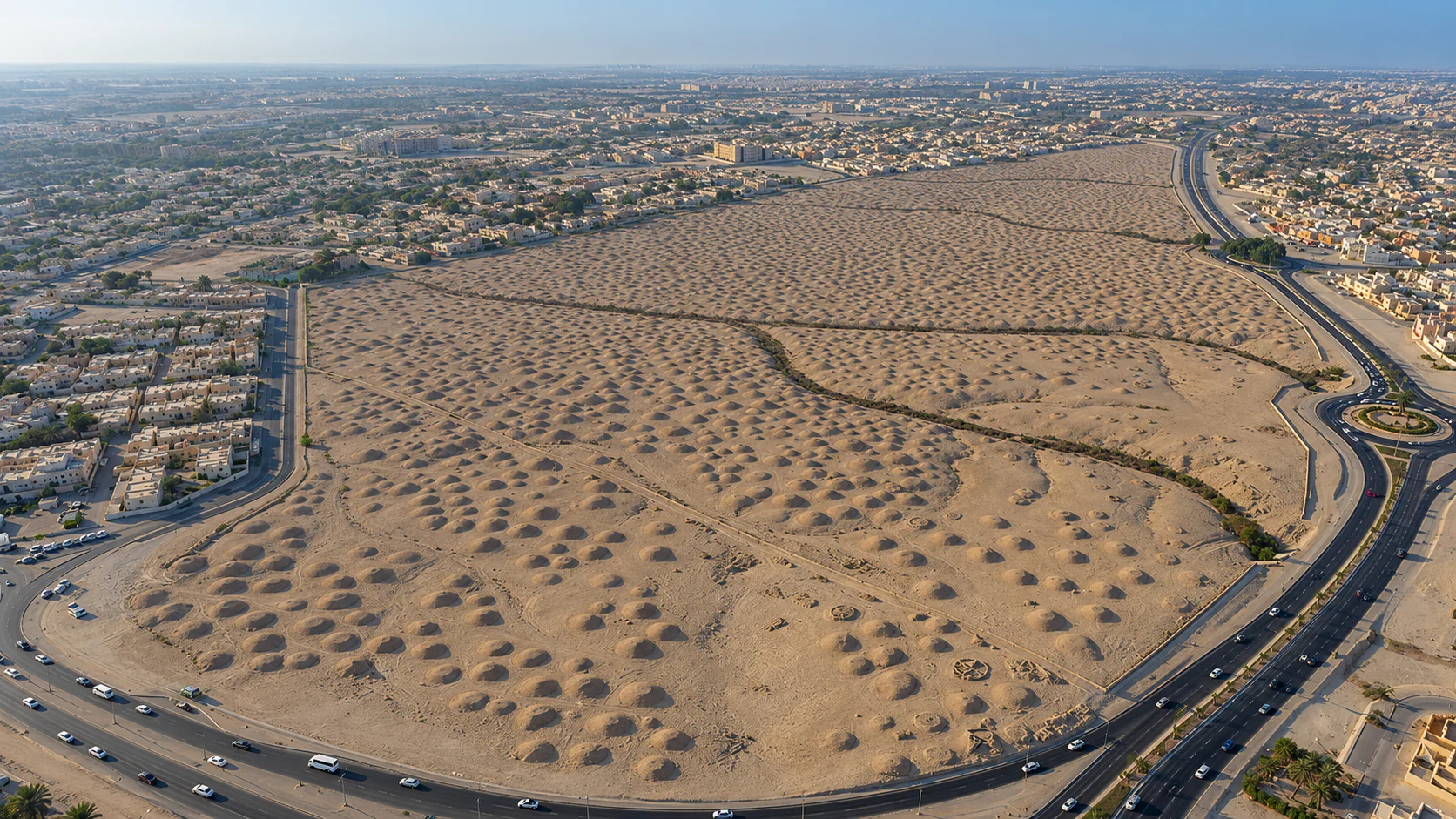
A’ali East is the largest of the island’s Dilmun cemeteries in the Culture Authority’s account, with 4,669 mounds. A’ali West continues a landscape now divided by a highway and contains a different pattern at the cemetery edge. The royal monuments form another set of protected components embedded in the village.
These names identify archaeological areas, not three doors into one enclosed museum. A visit should use the viewing place and approach advised by the heritage team. The saved point marks the A’ali burial landscape near the royal cemetery; it is not an authorised chamber entrance or a permission to cross an excavation.
A museum makes the inside legible
The National Museum’s Hall of Dilmun Graves is a strong companion. Its reconstructed burial architecture makes the chambers visible in a way an outdoor mound cannot. A museum visit before A’ali helps the visitor connect a ring of masonry, an internal chamber and the covering structure.
The sequence also works in reverse. After seeing the landscape, the museum can answer questions about how a tomb was built and what archaeological excavation reveals. The outdoor and indoor experiences have different strengths rather than competing to show the same view.
A visit based on landscape and interpretation
Allow roughly 45–75 minutes for a selected outdoor stop, with longer for a guide or specifically arranged archaeological access. Daylight, suitable ground conditions and a safe viewing position matter more than completing a checklist of numbered monuments.
The visit does not depend on going inside a tomb. Unexcavated mounds retain evidence below the surface, and exposed structures can be restricted for conservation and safety. Stay on the permitted route, avoid climbing and use the museum for a close view of construction when chamber access is unavailable.
A’ali’s pottery workshops add a different subject within the village outing. The existing Al-Shughul guide covers a living craft business with its own arrival and participation arrangements. Together, the two visits connect an ancient burial landscape with present-day production without turning a workshop into an archaeological entrance.
The story
History & character.
Early Dilmun in the Gulf
The mound fields belong to the society that made Bahrain an important centre of Gulf exchange in the late third and early second millennia BC. Maritime connections joined the island to Mesopotamia and regions farther east, while settlements, agriculture and local production supported life on land.
Burial architecture records another side of that society. A settlement reveals where people worked and lived; a cemetery shows how communities invested in the dead and expressed relationships after death. The two forms of evidence are strongest when considered together.
The UNESCO property’s broad construction span is approximately 2200–1750 BCE. Within that period, archaeologists distinguish different phases and forms. The dense later fields at A’ali are particularly associated with the centuries around the beginning of the second millennium BCE.
Before the rounded mound
The familiar appearance is partly the result of time. Many tombs were originally built with a cylindrical retaining structure rather than an irregular heap of material. Stone chambers lay within a constructed monument, and larger examples developed an upper stage.
Erosion changed the exterior profile, leaving rounded masses where a more architectural form once stood. Excavation reveals walls and internal arrangements, while surviving unexcavated forms preserve the broader density and distribution of the cemetery.
This distinction is important for a first visit. The mound is not merely packing around a spectacular hidden room. Its exterior construction, the way it meets the ground and its position among other monuments are also archaeological evidence.
Early and Late Types
Archaeologists use Early Type and Late Type to describe differences within the Early Dilmun burial tradition. “Late Type” does not mean the much later period called Late Dilmun. It is a classification of tombs within an earlier historical sequence.
Early forms are generally smaller and more scattered; later forms commonly create denser fields. Chamber layouts, covering stones, retaining walls and associated finds help distinguish them. The categories are tools for understanding development rather than a way for an unaided visitor to date every mound by its outline.
The shift towards denser cemeteries also raises questions about settlement and community. Burial locations were chosen within a landscape of water, useful land and inhabited places. A map can show relationships that disappear when one tomb is considered in isolation.
Chamber, alcove and capstone
A chamber is the burial space; alcoves open from it and can hold offerings. Stone slabs could cover the structure, while ring walls defined the outer construction. Some more elaborate monuments used passages or shafts and more than one level.
The parts worked together. A chamber’s form alone does not explain the entire monument, and a ring visible after excavation is only one surviving element. Museum reconstructions and published plans make their relationships easier to follow.
Construction required the collection, movement and arrangement of material. The scale of a monument therefore reflects organised labour as well as the status attached to the burial. A small tomb and a royal structure are different investments in the same broader tradition.
Burial and social difference
The variety of monuments provides evidence for social complexity. Some were relatively modest; others required exceptional resources and architectural ambition. Differences in associated goods and construction help researchers examine the emergence of elites.
The evidence is not a simple ledger of personal wealth. Graves can be disturbed, offerings can decay and different communities can express status in different ways. Interpretation depends on the combination of architecture, finds and context.
The term “royal” has a research history. Earlier accounts inferred high rank largely from monumental scale; later work added inscriptions and more detailed chronology. Current UNESCO interpretation relates the names Ri’ Mum and Yagli-‘El to the evidence associated with royal mounds 8 and 10.
Royal architecture at A’ali
The largest monuments concentrate the architectural contrasts visible across the cemetery. Their elaborate chambers and staged exterior forms expressed distinction within a landscape shared with many other burials. They were not modern underground rooms reached by a visitor staircase.
Research at A’ali has examined how royal monuments developed over time and how that development relates to authority in Dilmun. The Bahrain–Moesgaard investigations of 2010–2016 added important data to the study of kingship and the cemetery’s sequence.
A royal mound can be historically important without being open inside. Its role in the guide is to explain monumental burial and the village landscape. Exact access to an excavated chamber requires a specific arrangement through the heritage team.
Objects placed with the dead
Ceramics, beads and other goods form part of the burial evidence. Their material and manufacture can connect a local tomb to wider networks of exchange. An imported object may have travelled before being placed in a grave, while a locally made vessel records another part of the society’s work.
A findspot matters. The same kind of bead in two different graves does not make their occupants identical, and an attractive object without its archaeological context tells less than a modest fragment whose position is known.
Some materials survive better than others, and some tombs were opened or robbed long ago. The objects recovered are therefore a surviving portion of the original burial, not an untouched inventory of everything a family intended to place there.
Reuse and later burial
The island’s burial history continued after Early Dilmun. Later people reused parts of older cemetery landscapes and built other kinds of tombs. A’ali East includes evidence of a multiple burial that differs from the individual-burial pattern central to the earlier tradition.
This longer history prevents the landscape from becoming one undifferentiated Bronze Age scene. A mound field can contain changes, exceptions and later interventions. The date of a famous cemetery does not automatically date every structure near it.
Tylos-period burial belongs to a later chapter of Bahrain’s history. It can be explored through the National Museum and dedicated research, rather than folding every later grave into the construction story of the Early Dilmun mounds.
Exploration, excavation and mapping
The scale of Bahrain’s mound fields attracted travellers and early excavators. Twentieth-century archaeological work developed classifications and connected the burials with settlement evidence. More recent research combines earlier records with new excavation and mapping.
The Bahrain Burial Mound Project used historic aerial photographs to reconstruct a landscape much larger than the fields visible today. Its work links spatial patterns with excavation data, making it possible to ask how cemeteries, settlements and higher-status monuments related.
This method matters because urban expansion removed large parts of the original burial landscape. An isolated surviving mound can be understood more fully when earlier photographs show what once surrounded it. Conservation protects individual structures and also the relationships that remain between them.
A protected landscape within a village
The 2019 World Heritage inscription recognises the scale, construction and social evidence of the surviving property. It combines large fields with monuments now surrounded by modern A’ali. The boundaries reflect both archaeological significance and the history of survival.
That urban setting is central to the experience. Roads and houses make the distance in time visible, while also creating practical limits on movement and viewing. The appropriate route respects both the archaeological site and the current neighbourhood.
The work continues through research, protection and interpretation. Leaving an unexcavated mound intact is part of that process: not every important structure needs to be opened for a visitor to understand why it matters.
Look closer
Highlights and hidden details.
A’ali East’s dense field
The eastern field shows the repeated scale of the burial tradition. The Culture Authority records 4,669 mounds, with small groups and chains arranged across terrain crossed by dry water channels.
Look at distribution as well as individual shape. The landscape helps explain why a cemetery is more than a collection of isolated tombs, even where a particular chamber remains concealed.
A’ali West and the cemetery edge
The western field is the continuation of a landscape now divided from A’ali East by the Shaikh Khalifa Bin Salman Highway. It preserves a pattern at the edge of the cemetery that differs from the dense central areas.
Larger spacing and special outer-ring forms are part of its archaeological interest. Its name is a component label, not a nearby pedestrian entrance reached by crossing the highway.
The royal mounds in the village
The royal monuments are embedded within modern A’ali. Their relationship to houses and roads makes both their size and their survival conspicuous.
The World Heritage property groups seventeen royal mounds into fifteen components. Those counts describe protected groupings and monuments respectively; they are not competing totals for the same thing.
Mounds 8 and 10 in the research story
Current World Heritage interpretation relates named Dilmun kings, Ri’ Mum and Yagli-‘El, to evidence associated with these royal monuments. The significance lies in connecting monumental burial with written evidence.
This is a historical highlight, not a promise of entry or of seeing an inscription in place. Ask the heritage team about current interpretation and access to the relevant monuments.
Cylindrical towers beneath rounded forms
The original retaining walls gave many tombs a more architectural exterior than the eroded outline visible today. Low cylinders and staged larger monuments are a useful way to imagine the built landscape.
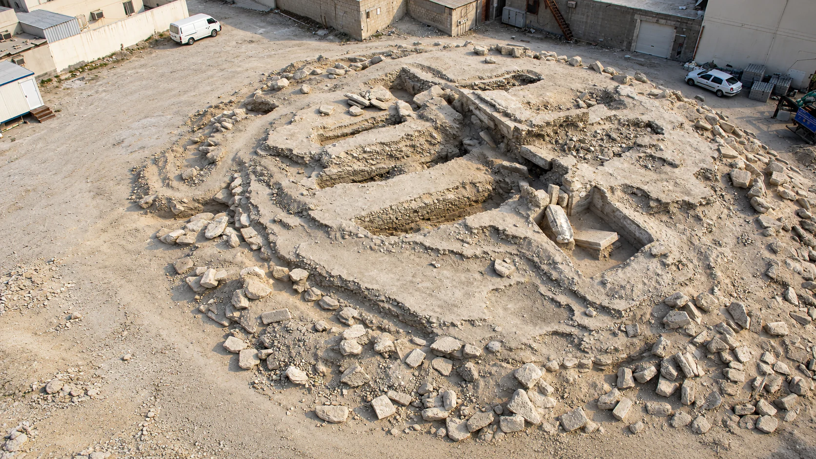
A plan or museum reconstruction is particularly helpful. Do not interpret a modern pile of exposed stones as a complete original roof or outer form without the site's explanation.
Chambers and alcoves
The burial chamber and its alcoves organise the inside of a tomb. Offering spaces are part of the architecture, not merely gaps created when a mound collapsed.
These details are best explored through approved interpretation or the National Museum’s displays. The absence of open interior access does not mean their form cannot be understood.
Ring walls and larger monuments
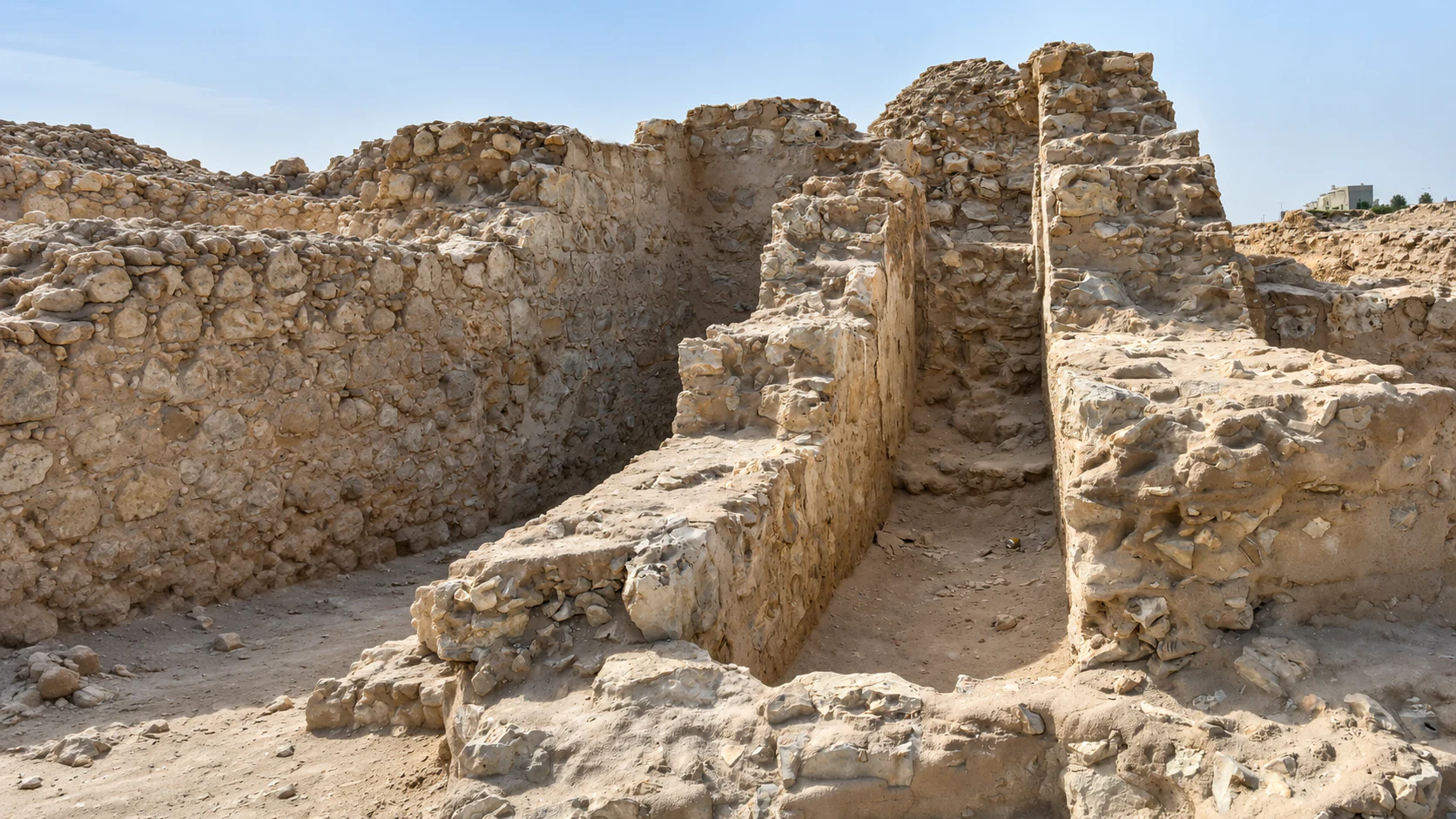
Ring walls defined and retained parts of the mound construction. Some higher-status types have an additional outer ring, providing another architectural distinction beyond height.
An excavated ring should be viewed from the permitted position. Walking along the stones would damage the evidence you came to see and may be unsafe.
Subsidiary burials
Some monuments have additional smaller burials connected with a principal structure. These relationships contribute to research on family and social organisation.
A cluster is not automatically proof of a known family tree. The architecture gives evidence for association, while identities and exact relationships require other kinds of research.
Dry channels and the choice of ground
The lie of the land helped shape the cemetery. Dry channels and differences between useful cultivated ground and burial areas form part of the wider setting.
The landscape is easiest to read from an advised public position or through a map. Do not enter a channel or unmarked route in search of a higher viewpoint.
The National Museum’s burial structures
The National Museum provides the indoor counterpart to the field. Reconstructed architecture makes the internal form visible and helps relate tomb building to the artefacts and people of Dilmun.
Allow a separate visit and transfer. The museum is in Manama, rather than an on-site building reached by walking through the A’ali field.
Pottery beside the archaeological landscape
A’ali’s continuing pottery tradition adds another material story to the village. Vessels in archaeology and vessels being made today invite a comparison of form, manufacture and use.
Al-Shughul Workshop is an existing named business with its own visitor guide. A craft session is arranged there; it does not include tomb entry.
Details to look for.
A shape made by erosion
The present mound can disguise the structure that produced it. A cylindrical retaining wall and a carefully built interior become a softer profile as material moves and the exterior weathers.
This is one reason to begin with a reconstruction or plan. It gives the eye something specific to look for outside, without encouraging a visitor to expose stones to prove the point.
Late Type is not Late Dilmun
Archaeological terminology can make two different timelines sound alike. A Late Type tomb can belong to the Early Dilmun period. “Late” describes its place within a sequence of forms, not a leap to every later century of Bahrain’s history.
The distinction makes museum and site labels easier to follow. Keep the period and the architectural type together when looking at a named example.
An empty-looking surface can preserve evidence
An unexcavated mound may reveal less structure to the visitor, but it can retain relationships below ground that would be lost by uncontrolled digging. Its value is not measured by the amount of exposed masonry.
The repeated forms across a field also preserve information about arrangement and density. Those relationships can survive where there is little dramatic architecture above the surface.
Size and labour
A larger monument required more than a larger pile of material. It involved organisation, construction choices and the ability to command resources. This is one route from architecture to questions about authority.
The small mounds matter within that comparison. Looking only at a royal monument removes the wider social landscape that makes its exceptional scale meaningful.
Space for an offering
An alcove is an architectural feature with a particular relationship to the chamber. Its contents, when recovered in context, can add information about ritual and material culture.
An offering is not a direct biography of the person buried. Objects may connect trade, belief and family decisions, and preservation determines what survives for study.
A line on the modern map
The division between A’ali East and West is sharpened by modern infrastructure. The ancient landscape and the current route through it are therefore not the same map.
This matters practically as well as historically. A short straight line between two labels can conceal a road barrier and the absence of a pedestrian crossing. Use the advised approach rather than a guessed shortcut.
A royal name is another kind of evidence
An inscription adds something different from scale alone. It can connect a name and title with the broader research history of a monument, while excavation establishes the context in which the inscribed material was found.
It does not make every neighbouring burial the tomb of an identifiable ruler. Different forms of evidence answer different questions, which is why the field and the museum are useful together.
04 / Before you go
Plan your visit
See the mound fields and royal burial landscape of ancient Dilmun at A’ali, with thousands of Bronze Age tombs beside the modern village.
Prices
Heritage access by enquiry
Ask about any guided-visit or site-access charge. No general ticket or guaranteed tomb-interior admission is offered here.
Visiting hours
Plan outdoor viewing in daylight. Guided visits, excavations and chamber access require specific arrangements with the heritage team.
Getting there
A’ali burial-mounds area, Block 738, A’ali, Bahrain
Plan your visit
Contact Culture Authority visitor information for the appropriate viewing area, guide and any restricted archaeological access. The map marks the A’ali burial landscape, not an authorised tomb entrance.
Accessibility
The ground is uneven, exposed and archaeological. Ask about a suitable roadside viewing position and avoid climbing mounds or entering excavations.
Establish the viewing area first
The guide uses the government-listed A’ali burial-mounds point near the royal cemetery. It represents the landscape, not an entrance to every protected component. Ask Culture Authority visitor information which viewing position and public approach suit the date and your needs.
A’ali East, A’ali West and individual royal monuments are different areas. A map can help with orientation, but it should not lead you across a highway, private property or an archaeological barrier in pursuit of the next label.
Museum before landscape
For a first archaeology visit, the National Museum’s burial hall can make the outdoor stop much more legible. Look at the relationship of chamber and exterior structure indoors, then carry that understanding into the field.
The museum and A’ali need a road connection. Its visit time is additional to the 45–75 minutes suggested for a selected outdoor heritage stop. The museum closes Tuesday, while an A’ali access arrangement has its own conditions.
Carry three museum details into the landscape
The burial hall’s reconstructed structures show the chamber and the stonework around it. At A’ali, much of that interior remains covered, so the visible exterior should be read as the enclosing architecture of a tomb rather than a natural hill.
The museum’s field model introduces the repeated forms of a cemetery. Outside, look at the spacing of the mounds and the change from dense fields to larger monuments. A single photograph of an exposed chamber cannot show that wider pattern.
Finally, connect the offering alcoves shown in the interpretation with the construction of the burial space. They are part of the chamber plan, while the objects recovered there belong in their archaeological context. The museum supplies the close view; the permitted outdoor position supplies scale and setting.
Landscape before museum
An outdoor visit can also begin with scale: the repetition of small mounds, the separation of larger monuments and the edge of the modern village. A guide helps connect the view to forms that are not visible beneath the covering.
Afterwards, use the museum to explore the interior construction and finds. This sequence suits visitors who first want a place in the landscape before looking at its objects.
One area rather than every component
A focused stop can include an approved view of a dense field and interpretation of the royal cemetery without trying to reach all the named parts. A longer guided visit may add detail, but the day’s access permissions determine the actual sequence.
The wider World Heritage property extends beyond A’ali. Completing all its components is not necessary for understanding the subject, and there is no promise of a continuous visitor footpath linking them.
Pottery as a second subject
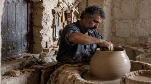
The separately listed Al-Shughul Workshop offers a living craft visit in A’ali. It adds present-day making to the outing, with its own address and any participation arranged directly.
The workshop should be a deliberate second stop rather than a shortcut to a tomb. Historic accounts of pottery businesses beside the mounds do not grant archaeological entry through a current business.
Returning from the stop
Agree a safe pickup point reachable from the permitted route. Do not ask a driver to stop on a highway shoulder for a photograph or depend on collection inside an excavation area.
If heat, mobility or the access arrangements make the planned walk unsuitable, keep to the advised viewing position. A shorter interpreted view is more useful than an improvised scramble onto fragile ground.
Visit your way
Access and family planning.
Viewing and entering are different arrangements
The general outing is landscape viewing from an appropriate permitted position. Entering an excavation, crossing a protected area or going into a chamber requires specific advice and permission from the heritage team.
Ask visitor information to name the public approach and viewing area for your visit. The existing map point identifies the A’ali burial landscape, not a certified step-free entrance or an authorised tomb doorway.
Uneven and exposed ground
Archaeological surfaces can include loose stones, changes of level and unprotected edges. The mound exterior is not a walking path. A safe-looking slope should not be used as a shortcut onto a monument.
A roadside or boundary view may suit a visitor who cannot cover the field, but it must be a safe stopping position approved for the route. Do not plan to remain on a highway shoulder or cross fast traffic for a better view.
Mobility and stamina
Describe the distance and assistance you can manage when enquiring. Ask whether a suitable viewing place can be reached from the vehicle and whether any steps or rough surfaces intervene.
Continuous shade, seating and accessible toilets are not established throughout the landscape. A short visit with a vehicle nearby may be more suitable than a long outdoor circuit. The National Museum provides a separate way to understand the architecture, subject to its own access arrangements.
Information and sensory needs
A field of covered structures can be difficult to interpret without a guide, plan or museum preparation. Ask what explanatory support is available for the date and viewing place. Specialist tactile routes, hearing loops and audio description are not promised by this guide.
The outdoor setting can be bright and exposed. Visitors who find glare or heat difficult can keep the field stop brief and use indoor collection displays for more detailed interpretation.
Begin with a building question
Ask whether the mounds are natural hills or structures made by people. A museum reconstruction or a simple published plan gives a clear answer before an outdoor visit, where much of the construction is covered.
For younger children, a short view of the field and a comparison between small and large monuments may be enough. There is no need to make the outing a lesson in every archaeological period.
Tombs are not climbing hills
The rounded shapes can look like places to run, but they are protected burials with fragile material, uneven ground and possible excavation edges. Keep children on the permitted route and away from exposed stonework.
An adult should explain that the site concerns people who were buried here. Treating it as a real cemetery, rather than a treasure-hunting game, gives the visit an appropriate tone.
Make the museum the close-up
The National Museum can show the chamber and its enclosing structure without asking children to imagine everything beneath an outdoor mound. It is also a useful alternative when heat or field access makes a longer walk unsuitable.
Burial displays may involve human remains or material relating to death. Parents can choose the emphasis and the amount appropriate to the child’s age and comfort.
A shorter village outing
A pottery visit can offer a second, different focus if the workshop has agreed the arrangements. Watching or participating in a current craft has its own conditions; it is not automatically included with a heritage stop.
Carry water and choose a brief daylight visit when outdoor conditions are comfortable. Strollers may be unsuitable on archaeological ground, and there is no promise of shade, play facilities or toilets at every viewing position.
Self-guided walk
Explore beyond the venue.
A practical, step-by-step route connecting this experience with more of Sakhir.Prepare the inside before going outside
If possible, visit the National Museum’s burial hall first. Look at the relationship between chamber, alcoves and the outer structure. A plan or reconstruction gives the field a clearer architectural meaning.
This museum time is additional to the outdoor stop. If you have not visited it, a heritage guide or the available official interpretation can provide the same starting questions.
Arrive at the agreed A’ali position
Use the public approach and viewing place identified by Culture Authority visitor information. Keep to public roads and pavements and any marked visitor path the heritage team identifies for the visit. Mound crests, exposed ring walls, chamber passages, excavation areas and private workshop yards are outside this self-guided route. The area pin is for orientation, not permission to enter the field or a tomb.
Allow roughly 10–15 minutes to establish the setting and the limits of the permitted route. Begin by looking at the field as a whole rather than moving directly towards the nearest exposed stones.
Read the pattern of mounds
From the approved position, spend about 15–20 minutes with density, spacing and changes of scale. Notice the lie of the ground and the relationship of the cemetery to the modern village.
The task is observation, not a search for an open hole. An intact covering can preserve evidence and does not make a mound less valuable than an excavated neighbour.
Explore the royal story through interpretation
Use the guide or site information to connect the larger monuments with the history of elite burial and kingship. Where a public view of an identified royal monument is part of the arrangement, allow time to understand its scale and context.
A route among numbered royal monuments requires the heritage team’s actual entrance and access instructions. Follow the boundaries and signs on the day. Crossings or openings between A’ali East and West are not assumed; arrange road transport if both areas are included.
Finish the field stop
Return along the permitted route to the agreed pickup. The suggested outdoor visit takes about 45–75 minutes, depending on access, conditions and interpretation. It is not a booked tour or a measured path connecting all components.
If you want a pottery session, continue to the named workshop using its own arrival instructions. If you want more archaeological detail, return to the museum or add a separately planned Bahrain Fort visit.
Make a record
Photograph it thoughtfully.
Include repetition and scale
A wide view can show the density of the field and the difference between smaller mounds and larger monuments. A close image of rubble often loses that relationship.
Where the permitted viewpoint allows, include part of the modern village edge. It records the actual setting of the surviving cemetery rather than presenting A’ali as an empty desert.
Work from the public position
Do not climb a mound, step onto a ring wall or enter an excavation for a higher angle. These actions can damage fragile fabric and bring you close to unsafe ground.
A published aerial image does not establish permission to launch a drone. Any specialist or commercial photography requires the relevant arrangements, and the day's access restrictions still apply.
Exposed masonry
When a structure can be seen from the permitted route, a wider contextual view should come before a tight detail. The chamber, ring wall and surrounding ground explain how the visible stones relate.
Keep image labels attached to what can actually be identified. A photograph of one exposed wall is not enough to assign it to a particular numbered royal mound, ruler or construction phase without the site's information.
Light and the surface
Lower-angle daylight can make the relief of rounded forms easier to see. It is useful for landscape photography, but it does not justify arriving after permitted access ends or walking on a mound to chase a shadow.
Heat and glare can also limit how long a group wants to remain outside. Plan a safe viewing period rather than making a photograph the reason to extend an unsuitable stop.
Village and working businesses
A’ali includes private homes and craft businesses. Ask before identifiable portraits or photographs inside a workshop, and keep equipment clear of entrances and working space.
The burial landscape can be documented respectfully without treating residents or workers as part of a staged historical scene. Nothing needs to be moved, handled or uncovered for a visitor image.
See it
In pictures.
8 views, full screen. Tap any one to open the viewer.Around here
Make more of the area.
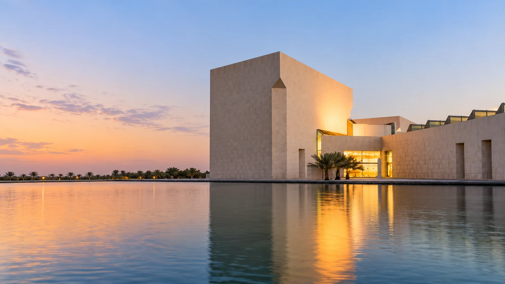
The National Museum is the strongest companion to the mounds. Its burial structures provide the close view of internal construction that is usually concealed outside, while the Dilmun collections introduce objects and settlement life.
Allow separate time for its halls and the road journey. A museum visit is particularly useful before the field, though it can also answer questions raised by the landscape afterwards.
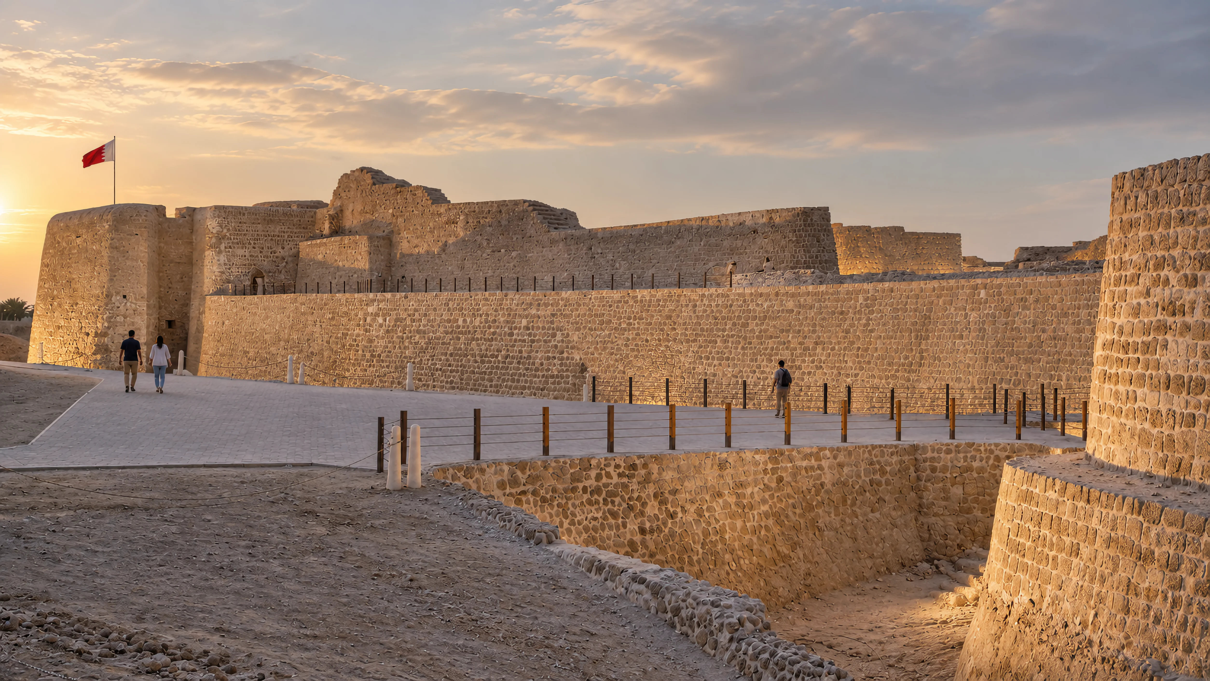
Bahrain Fort provides an inhabited counterpart: streets, monumental buildings and a harbour settlement. Its site museum concentrates on the finds and sequence of Qal’at al-Bahrain.
Together, the sites broaden Dilmun beyond burial alone. They are separate places with different arrival points and access arrangements, not two parts of a continuous walking circuit.
Good to know
Questions, answered.
What are the Dilmun Burial Mounds at A’ali in Bahrain?
The Dilmun Burial Mounds at A’ali form an ancient burial landscape within a modern village. The rounded mounds cover deliberately constructed tombs; larger royal monuments form another part of the cemetery. The guide concentrates on A’ali rather than every component of the wider property.
How old are Bahrain’s Dilmun Burial Mounds?
Bahrain’s Dilmun Burial Mounds World Heritage property covers burial construction broadly between about 2200 and 1750 BCE. Different forms and fields belong to phases within that span, with later reuse and other burial periods adding complexity at some locations.
Are the Dilmun Burial Mounds natural hills or constructed tombs?
The Dilmun Burial Mounds are constructed tombs. Many began as low cylindrical burial towers, with chambers and retaining walls. Erosion changed their exterior appearance into the rounded forms visible today.
How do Early Type and Late Type Dilmun burial mounds differ?
Early Type and Late Type are architectural classifications within the Early Dilmun burial tradition. Late Type does not mean the separate, much later historical period called Late Dilmun. Plans, construction and finds help archaeologists distinguish them.
Why are some A’ali burial mounds described as royal tombs?
A’ali’s royal mounds have exceptional size and elaborate architecture indicating high-status burial. Later research added written evidence and more detailed chronology to earlier interpretations based largely on scale.
Which Dilmun rulers are linked to A’ali’s royal burial mounds?
UNESCO’s interpretation of A’ali’s royal mounds relates Ri’ Mum and Yagli-‘El to evidence associated with royal mounds 8 and 10. That research does not mean a visitor can enter the monuments or see the inscriptions in place.
How many Dilmun Burial Mounds are included in Bahrain’s UNESCO World Heritage site?
UNESCO describes about 11,774 mounds in six fields, plus seventeen royal mounds grouped into fifteen components. The property has twenty-one components overall. These are different counting units.
How many burial mounds are in the A’ali East field?
The Culture Authority records 4,669 mounds in the eastern field. A’ali West is a separate component, and the royal monuments are grouped separately within the village.
Can visitors walk between A’ali East and A’ali West burial mound fields?
A continuous public footpath between A’ali East and West has not been established. Modern roads, including a highway, divide the landscape. Ask about the appropriate approach and safe transport between any areas included in your visit.
Can visitors go inside a Dilmun burial mound at A’ali?
Entry inside an A’ali Dilmun tomb requires specific authorised access. The general visit is landscape viewing, and excavations or chambers may be restricted for conservation and safety. The National Museum offers a separate view of reconstructed burial architecture.
Are the Dilmun Burial Mounds at A’ali open all day?
Plan daylight viewing of A’ali’s Dilmun Burial Mounds with heritage visitor advice. Guided visits, excavations and tomb chambers require specific arrangements; unrestricted twenty-four-hour access is not established.
Do I need an admission ticket to visit the Dilmun Burial Mounds at A’ali?
Ask Culture Authority visitor information about the selected Dilmun Burial Mounds viewing area and any guided or archaeological access charge. There is no general ticket or guaranteed chamber admission offered by this guide.
Where should I go to see the Dilmun Burial Mounds at A’ali?
The map marks the government-listed A’ali burial landscape near the royal cemetery. Ask heritage visitor information for the permitted approach; the pin does not identify an authorised tomb entrance or parking bay.
How long should I allow for a visit to the Dilmun Burial Mounds at A’ali?
Allow around 45–75 minutes for a selected outdoor visit to the Dilmun Burial Mounds at A’ali. A guide or authorised archaeological access can take longer; the National Museum and pottery workshops are additional stops.
Should I visit Bahrain National Museum before the Dilmun Burial Mounds?
Bahrain National Museum is a useful introduction to A’ali’s Dilmun Burial Mounds because its reconstructed burial structures reveal the chambers and construction hidden beneath a mound’s exterior. The museum can also be visited afterwards.
Are the Dilmun Burial Mounds at A’ali suitable for children?
A short interpreted view can work well, especially after a museum introduction. Children should stay on the permitted route and off the mounds and exposed stonework. Choose an age-appropriate approach to burial material.
Are A’ali’s Dilmun Burial Mounds wheelchair accessible?
A comprehensive step-free route through A’ali’s Dilmun mound fields has not been established. Ask about a safe viewing position reachable from the vehicle and the surfaces on its approach. Archaeological ground is uneven and exposed.
Can I combine the Dilmun Burial Mounds with an A’ali pottery workshop?
An A’ali pottery workshop such as Al-Shughul can be combined with the Dilmun Burial Mounds as a separately arranged stop. The craft visit has its own location and conditions and does not include archaeological entry.
Can I photograph the Dilmun Burial Mounds or fly a drone at A’ali?
At the Dilmun Burial Mounds at A’ali, photograph only from permitted public positions and follow current restrictions. Do not climb for a view. Drone and commercial work need the relevant permission rather than relying on the existence of published aerial images.
Why have some of Bahrain’s Dilmun Burial Mounds been left unexcavated?
Unexcavated Dilmun Burial Mounds preserve material and relationships for future archaeological research. Their arrangement and intact structures remain evidence even when visitors cannot see inside.
Editorial notes
Sources and further reading.
Sources for this guide
Research reviewed 28 October 2026. The register distinguishes direct reads, official indexed evidence and unchanged accepted source contracts. Suggested routes and durations are Above.Guide editorial selections, not surveyed paths, reservations or operator tour schedules.
Source register
S01. UNESCO: Dilmun Burial Mounds
Reviewed 28 October 2026: Direct page read. 2019 inscription, broad 2200–1750 BCE chronology, fields versus royal components, original cylindrical forms and wider social significance. Current property interpretation takes precedence over older tentative-list wording.
S02. Culture Authority: A’ali East
Reviewed 28 October 2026: Official indexed component account read. 4,669 mounds, dry channels, groups/chains and a distinct multiple burial with later reuse. It is not interpreted as a public path through every monument or a current chamber-opening programme.
S03. Culture Authority: A’ali West
Reviewed 28 October 2026: Official indexed component account read. 723 mounds, cemetery-edge pattern, outer-ring forms and highway division from East. Names identify archaeological components, not entrances connected by a pedestrian shortcut.
S04. Culture Authority: typology
Reviewed 28 October 2026: Official indexed typology read. Early/Late Type within Early Dilmun; chambers, capstones, alcoves, rings, elite forms and subsidiary burials. The older reservation about identified monarchy is contextualised against later royal-mound research.
S05. Culture Authority: description and significance
Culture Authority: description and significance
Reviewed 28 October 2026: Official indexed page read; direct request timed out. Wider component geography and distinction between fields, social forms and royal groupings. No new itinerary points or unsourced coordinates are created from the component names.
S06. Bahrain nomination dossier
Reviewed 28 October 2026: UNESCO-hosted State Party document extracts read. Numbered royal monuments, village integration, archaeological construction/context and later change. A nomination map describes heritage geography; it does not supply current public entry rights.
S07. ICOMOS nomination evaluation, 2019
ICOMOS nomination evaluation, 2019
Reviewed 28 October 2026: Evaluation extracts read. Component structure and different cemetery groups; independent assessment context. The older proposed chronological range is distinguished from the adopted broader property description.
S08. World Heritage Committee decisions, 2019
World Heritage Committee decisions, 2019
Reviewed 28 October 2026: Committee decision extracts read. Adopted inscription and significance, protection and management themes. A historical management-plan period is not presented as proof of all visitor facilities operating today.
S09. Steffen Terp Laursen: The Royal Mounds of A’ali
Steffen Terp Laursen: The Royal Mounds of A’ali
Reviewed 28 October 2026: University publisher description read. 2017 research volume and Bahrain–Moesgaard expedition of 2010–2016, kingship and chronology. Full paid volume is not claimed read; precise uninspected plates and inventories are not invented.
S10. Royal-mounds research contents
Royal-mounds research contents
Reviewed 28 October 2026: Publisher contents extract read. Documents the volume’s inscription and specialist-study scope. A table of contents is not used as proof of a detailed find identification or current display location.
S11. Bahrain Burial Mound Project, Laursen and Johansen
Bahrain Burial Mound Project, Laursen and Johansen
Reviewed 28 October 2026: University research abstract read. Historic aerial photography, mapping and relational excavation evidence; landscape loss and the investigation of social organisation. Historical mapped totals are not labelled the current number of preserved or inscribed mounds.
S12. Flemming Højlund: The Burial Mounds of Bahrain
Flemming Højlund: The Burial Mounds of Bahrain
Reviewed 28 October 2026: University publisher record read. Foundational research bibliography and social-complexity subject. This bibliographic entry is not represented as access to a complete excavation volume.
S13. Jutland Archaeological Society catalogue
Jutland Archaeological Society catalogue
Reviewed 28 October 2026: Research publisher catalogue extracts read. Scope of Højlund’s burial-mound study and Laursen’s royal-mound volume. Used to distinguish research sources and publication scope, not for visitor operating conditions.
S14. Culture Authority: A’ali mounds and pottery
Culture Authority: A’ali mounds and pottery
Reviewed 28 October 2026: Official indexed destination account read. Historic relationship of burial landscape and working pottery. Historical reuse of tombs as kilns is not promoted as a current visitor entitlement or a commissioned workshop offer.
S15. Culture Authority: National Museum Hall of Graves
Culture Authority: National Museum Hall of Graves
Reviewed 28 October 2026: Same-day accepted institutional evidence reused; fresh direct request timed out. Burial reconstructions and the 2018 remodelled hall. The museum is a separate existing canonical venue and is not falsely placed at the A’ali field.
S16. Government historical-site locations
Government historical-site locations
Reviewed 28 October 2026: Existing accepted government coordinate receipt reused. Numeric area point 26.15269185, 50.51376072 near the royal cemetery. The point retains heritage-area precision; no claim that it is a parking bay, doorway or a permit to enter a tomb.
S17. Culture Authority: Buri component
Culture Authority: Buri component
Reviewed 28 October 2026: Official indexed component account read. Subsidiary-burial interpretation and the distinction between nearby fields. Broader components add historical context but are not new published map entities or a promised full-property walking route.
S18. Carlsberg Foundation: Dilmun expedition history
Carlsberg Foundation: Dilmun expedition history
Reviewed 28 October 2026: Research funder historical account read. Context for the twentieth-century search for Dilmun. Mythic paradise language is not converted into a literal proven location or a story that all the mounds were imported foreign burials.
Dates, counts and research development
The broad current property chronology is about 2200–1750 BCE. Older nomination and Culture Authority descriptions often concentrate on 2050–1750 or individual later field dates. These describe different scopes and stages of research. Early/Late Type within Early Dilmun is distinguished from the separate historical Late Dilmun period and later reuse.
The twenty-one protected components include six fields and fifteen groupings of seventeen royal monuments. The field count of about 11,774 mounds is not an estimate of all burials ever built in Bahrain. Historic aerial mapping and older survival totals answer different questions and are not substituted for the inscribed-property counts.
Current UNESCO interpretation and later royal-mound research add named-king evidence to earlier arguments based on monumental architecture. That does not identify every burial, guarantee an inscription remains in place or establish a public interior route. Paid specialist volumes are cited through the publisher information actually reviewed; the complete books have not been claimed read.
Public viewing and restricted archaeology
The guide retains the accepted government-sourced A’ali area point and Culture Authority telephone enquiry. Public approach, safe viewing location, guiding, any charge and archaeological access must follow the heritage team’s arrangements. The article does not offer unrestricted field entry, a free general ticket, an open tomb or a safe pedestrian crossing between East and West.
Detailed Culture Authority direct requests timed out while official indexed material was available. The National Museum account and coordinate feed reuse accepted same-day evidence where unchanged. Those conditions are distinguished from successful direct retrieval, and no call or reservation has been made.
Review limits and maintenance
No app was built, served or rendered for this task. Content acceptance uses source/data inspection, factual evidence and the existing shared adapters. Current accessible routes, equipment, temporary closures and day-specific services remain matters for the responsible venue or heritage team; unsupported facilities are not promised.
Review operational details again before 15 February 2027 for the race travel period, or sooner when a reported change affects the visit. Dates and archaeological interpretations should be refreshed when new institutional evidence changes them. Image production and detailed authoring records remain outside visitor prose.
S19. Museum and site interpretation
Heritage Interpretation World: Bahrain’s World Heritage interpretation
Reviewed 28 October 2026 as an indexed institutional contribution. Describes the burial hall’s field model, full-size structural interpretation and object displays, alongside site interpretation boards. Used to connect chamber, field density and offering spaces with the landscape; not a guarantee that a specific device or current display is operating.
S20. Proposed visitor trail and public-space limits
Bahrain nomination dossier: visitor-trail proposal
State Party clarification on protection and local use
Reviewed indexed official dossier extracts on 28 October 2026. The nomination describes a proposed trail in an older tourism strategy; it is not proof of a completed open route in 2026. The clarification describes local public-space use and vehicle restrictions around royal monuments. Neither supplies a current authorised entrance or continuous visitor path. No exact walk-through geometry, gate location, parking bay or open chamber could be accepted from these records. The public guidance is therefore restricted to public circulation and any visitor path identified by the heritage team. A certified field itinerary remains unresolved.
Opening hours, prices, programmes and access arrangements can change. Confirm critical details with the venue.
Continue exploring / Bahrain
More to explore
in Bahrain
Find another place for your itinerary, or explore all things to do in Bahrain.
 Bahraini & casual diningJasmi’s in Zayed TownExplore experience →
 Bahraini & casual diningSameeh Pastries & Restaurant in RiffaExplore experience →
 Cafés & bakeriesCrème at Al Liwan, HamalaExplore experience →
 Cultural districtsA’ali pottery at Al-Shughul WorkshopExplore experience →