Williamsburg
Bedford Avenue, vintage shops, industrial waterfronts and the Williamsburg Bridge.
01 / The experience
From Bedford Avenue to the working waterfront’s remains.
Bedford Avenue, vintage shops, industrial waterfronts and the Williamsburg Bridge.
Bedford Avenue and the side streets.
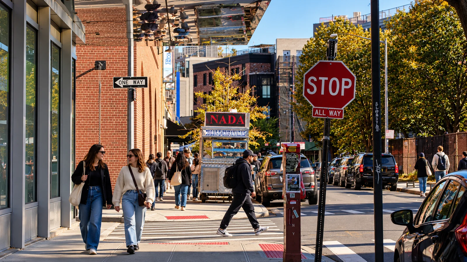
Bedford Avenue gives Williamsburg a busy street-level introduction. Shops sit below brick apartment buildings, metal fire escapes cross the upper façades, and the streets around North Seventh bring subway arrivals into the same space as people doing everyday neighbourhood errands. The avenue is a useful thread through the area, but the side streets and waterfront change the character of the visit. A short walk west exchanges shop windows and crossings for piers, industrial remains and a much wider view across the East River.
Berry Street provides a different way through the neighbourhood. Its redesigned crossings, planters and cycling markings give more space to people on foot and bikes, linking the streets towards Domino Park, McCarren Park and the bridge. Local vehicle access remains part of the arrangement, so it is a calmer street rather than a completely traffic-free precinct. North Fifth Street adds vintage-shopping racks and smaller storefronts, while Metropolitan Avenue presents another commercial row beneath red-brick upper floors and iron fire escapes. These streets make the neighbourhood more than a collection of waterfront viewpoints.
Domino and the bridge.
Domino Park brings the industrial history into the public landscape. The former sugar-refinery site retains large pieces of machinery and structure beside lawns, planting and a riverside promenade. A turquoise crane and the brown steel of the elevated Artifact Walk are particularly recognisable. Columns from the former Raw Sugar Warehouse support the walkway, keeping the scale of the old works visible among the newer buildings. The public park and its paths are the visit; the surrounding buildings do not become open factory interiors simply because their façades can be seen from the riverfront.
The Williamsburg Bridge gives the southern streets another strong landmark. Its steel towers and suspension structure rise above brick blocks before the crossing opens towards Manhattan. Seeing it from the neighbourhood and walking across it are different outings, with the latter requiring time for the bridge approaches as well as the river span. Aska, on South Fifth Street, is an existing destination-dining choice in this part of Williamsburg, giving the southern end a separate evening purpose without treating a tasting-menu reservation as a casual stop during a street walk.
Parks, piers and Greenpoint.
Farther north on Kent Avenue, Marsha P. Johnson State Park honours the Black transgender activist and LGBTQ civil-rights pioneer. Its flower-covered gateway, planted paths and river-facing spaces give it an identity beyond the skyline. Remnants of the site’s shipping and railway past remain within the landscape. The North Fifth Street piers offer another waterfront setting nearby, with metal-railed decks and a view towards Midtown. Their relationship with the street grid is quite different from Domino’s long park edge.
McCarren Park changes the emphasis again. Mature trees, open lawns, paths and sporting spaces sit near the meeting of Williamsburg and Greenpoint, making it a useful connection between the two neighbourhoods. The park’s interior is a contrast to the exposed riverfront. Greenpoint continues beyond it with a different network of streets, church spires, shops and public waterfront spaces. Williamsburg can therefore be a focused neighbourhood visit or the beginning of a longer North Brooklyn exploration, with the subway and ferry providing separate ways to arrive and leave.
Food gives the streets several distinct stops. Win Son Bakery on Graham Avenue makes Taiwanese-American baking and substantial pancake sandwiches, while Jajaja Williamsburg brings a plant-based Mexican meal to Kent Avenue. Aska remains the occasion dinner on South Fifth Street. For an overnight base, Pod Brooklyn offers compact rooms and The William Vale has private balconies with different city outlooks.
In pictures
Streets and landmarks.
In pictures
Parks and public spaces.
In pictures
The waterfront and local life.
04 / Before you go
Plan your visit
Cost
Free
Walking the public streets and ordinary entry to the parks are free. Transport, food, shopping and separately ticketed or reserved visits are additional.
Opening
Public streets daily
Domino Park opens daily 06:00–23:00. Marsha P. Johnson State Park opens daily 07:00–22:00.
Berry Street permits local vehicle access; follow its posted pedestrian and cycling arrangements.
Shops, dining rooms, events and bridge works follow their own operating conditions.
Starting place
Bedford Av station, Bedford Avenue at North 7th Street, Brooklyn, NY 11211
Start at Bedford Av on the L, using the posted street exit for Bedford Avenue/North 7th Street. The map pin marks the station rather than an exact entrance. Marcy Av on the J/M/Z suits southern Williamsburg. North Williamsburg ferry landing is near North 6th Street/Kent Avenue; South Williamsburg is at 440 Kent Avenue.
Access & reservations
Public streets and ordinary park entry do not require a neighbourhood booking. Food, performances and other private venues have their own arrangements. Aska requires its separate dining reservation; a saved neighbourhood stop does not reserve a table.
Accessibility
Street crossings, surfaces and bridge approaches vary. Use the MTA accessible-trip planner for the actual station entrance and elevator status. Marsha P. Johnson State Park restricts dogs to its dog run; organised gatherings and shoots have separate permit rules.
Location & nearby places
Continue exploring
Continue around North Brooklyn.
06 / Good to know
Williamsburg: frequently asked questions
01Which ferry landing should I choose?
North Williamsburg is near North 6th Street and Kent Avenue; South Williamsburg is at 440 Kent Avenue. East River stopping patterns differ, so choose the named landing and direction in NYC Ferry’s timetable.
02Is Berry Street completely car-free?
No. Its redesigned crossings and cycling route support walking and cycling, with local vehicle access retained.
03Can I visit Domino’s buildings as part of the park?
The park and public paths are open under their own hours. The surrounding buildings have separate access; the neighbourhood walk does not include a factory-interior tour.